
The neighbourhoods of Moraira: what officially exists
Moraira has no neighbourhoods, not in any administrative sense. The municipality has two centres — Moraira on the coast and Teulada inland — and beyond those a series of urbanisations on the hills. What property adverts call “the neighbourhoods of Moraira” appears on the official map of the municipality as an urbanisation or as an area name. Below is what is really there, and what it means for you as a visitor. Calamora stands in the coastal centre itself.
1. Moraira: the village, the harbour and l’Ampolla
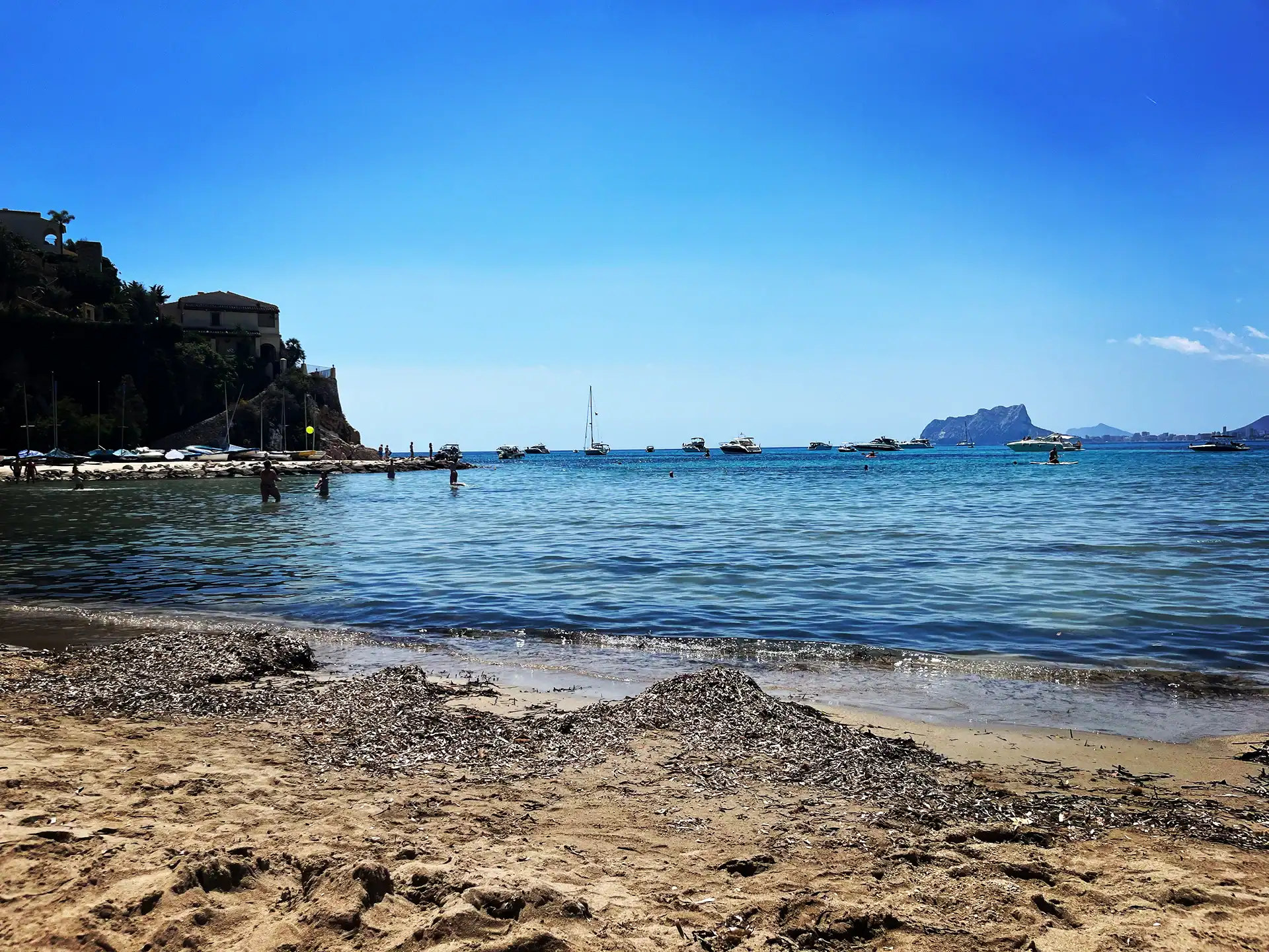
On the official toponymic map of the municipality, Moraira is a settlement, just like Teulada and el Portet. The village sits around the marina and the beach of l’Ampolla: 250 metres long and about 30 metres wide, with fine golden sand and calm water. It is an urban beach with walkways, lifeguards, foot showers, toilets, sunbed and parasol hire, a sports area and playgrounds, and it is wheelchair accessible. Right beside it lies the Marjal del Senillar, a coastal wetland declared a wildlife reserve. This is also where you find the shops and the market. 📍 View l’Ampolla on Google Maps.
2. El Portet: officially a settlement of its own
On that same map el Portet stands alongside Moraira and Teulada as an independent settlement, not as an urbanisation. The beach is 300 metres long and 10 metres wide, almost entirely sand with a few pebbly stretches, and in summer it has full services: lifeguards, parking, kayak hire and restaurants looking out to sea. Of all the beaches in the municipality, this one carries a Blue Flag, on the ADEAC lists for 2025 and for 2026-2027. In summer 2026 lifeguards are on duty Monday to Sunday from 11.00 to 19.00. Above the bay rises the Cap d’Or peninsula, with its watchtower and a plant micro-reserve; Cap d’Or is a cape, not a beach. 📍 View el Portet on Google Maps.
3. The coast road to Calpe: Les Platgetes and Cala l’Andrago
At kilometre 3 of the road from Moraira to Calp lie Les Platgetes: two small coves that alternate sand and rock, with a promenade viewpoint with gardens and a car park. This is a Blue Flag beach too, in 2025 and in 2026-2027, with the same lifeguard hours as el Portet. At kilometre 2 lies Cala l’Andrago: 150 metres long, 10 metres wide, and according to the municipality a cove with low occupancy. Rocks and deep clear water, good for diving and fishing. Out of season this cove is only cleaned by hand from time to time, so expect no beach maintenance in winter. 📍 View Les Platgetes on Google Maps.
4. The hills: twenty-three urbanisations
What people call the neighbourhoods are the urbanisations on the slopes around the coastal centre. The official map of the Academia Valenciana de la Llengua, drawn up with the municipality itself, lists twenty-three of them. Among others Benimeit, Cap Blanc, Pla de la Mar, La Sabatera, Castellons Vida, Club Cometa, Club Moraira, Colina del Portet, Moravit Pinada, Sol Park, Tabaira and Punta de l’Estrella. Mind the spelling, because it differs from what the adverts show: it is Pla de la Mar and not Pla del Mar, Sol Park as two words, and Moravit with a grave accent on the first a. Names that circulate in the property world as districts but do not appear on the official map of Teulada, such as El Bosque, therefore do not exist there. The same holds for all these urbanisations: views and quiet, and you will need a car. Anyone who would rather walk everywhere is better off in the coastal centre. 📍 View Benimeit on Google Maps.
5. Cala Llebeig: on foot or by boat only
No road runs to this cove on the border with Benitachell. You get there by boat or along the waymarked route SL-CV 50, which starts at Calle Canario 2 in Teulada and ends at Travesia Playa in Benitachell: 3.40 kilometres, a theoretical walking time of 1 hour 45, 345 metres of climb and 330 metres of descent. Around the bay stand the old fishermen’s huts, a few metres from the water. The route was homologated in 2004 by the hiking federation and was checked again in June 2025. Bring water: there is nothing to be had along these coastal paths. 📍 View Cala Llebeig on Google Maps.
6. Teulada, the inland centre
The second centre of the same municipality lies at 185 metres above sea level, eight kilometres from the coast. The whole municipal area covers 32 square kilometres and, according to its own tourism site, has around eleven thousand inhabitants. One thing worth knowing: the municipality is officially called Teulada. “Teulada-Moraira” is the name it presents itself under, not its administrative name. 📍 View Teulada on Google Maps.
Where you are best placed
For anyone who wants to manage without a car: the coastal centre of Moraira, within walking distance of the beach, the harbour and the shops. For anyone who puts the view above all else: the hills, with a car. Look at the beaches of Moraira and the practical information before you choose.
Book your stay at Calamora Moraira
Calamora stands in the coastal centre of Moraira, about 200 metres from the beach of l’Ampolla and within walking distance of the harbour and the shops. So you need no car for the village, and you do need one for the hills and the coves. Check availability of the apartment and the penthouse.
Before you set off
- Paid parking in the centre of Moraira
- Since 1 February 2023 paid parking (zona azul) applies in, among others, Avenida de Madrid, De la Paz, Paseo del Senillar, Dr. Calatayud from the church onwards, Del Portet up to the steps to Calle Almacenes, and the road to Calpe up to number 30. One hour costs € 0,85 and two hours € 1,70; for non-residents that is also the maximum. On Sundays and public holidays it is free. The council names the Les Sorts car park in Moraira as a free alternative: the council announcement.
- The hours differ by season
- From 1 July to 31 August it applies Monday to Saturday from 9.00 to 20.00. From 1 April to 30 June and from 1 September to 31 October on working days 9.00–14.00 and 16.00–20.00, Saturdays mornings only. From 1 November to 31 March mornings only, and the afternoons are free. The operator’s hours.
- Two beaches with a Blue Flag
- Of the beaches in the municipality, el Portet and Les Platgetes are on the ADEAC list, for 2025 and for 2026-2027. L’Ampolla is on neither list. The 2026-2027 list (pdf).
- Cala Llebeig: route SL-CV 50
- No road leads there, only foot or boat. The route is 3.40 kilometres, a theoretical walking time of 1 hour 45, with 345 metres of climb and 330 metres of descent. Map and gps track can be downloaded from the hiking federation FEMECV.
Rates and opening hours are from October 2026 and change by season; check them on the official site before you visit.
Stay at Calamora in Moraira
The coastal centre, el Portet and the coves along the coast road all lie within a quarter of an hour of Calamora. You notice the difference only once you are back: no hunt for a parking space, but the garden and the pool.


A maximum of 4 guests may stay here (infants not included).
You will not be charged yet
Why book directly with us
- No middleman and no booking fees
- Twenty per cent today, the rest only six weeks before you travel
- Plans changed? Your payment moves with you to another date
- Personal contact with us about arrival, keys and tips
Frequently asked questions about the neighbourhoods of Moraira
Does Moraira have official neighbourhoods?
No. The municipality has no administrative division into neighbourhoods or districts. The only list of place names published by a public authority is the toponymic map of the Academia Valenciana de la Llengua, drawn up with the municipality itself. On it, Moraira, el Portet, la Torreta and Casa de les Aigues are settlements, and names such as Benimeit and Cap Blanc are urbanisations.
Which beaches in Moraira have a Blue Flag?
El Portet and Les Platgetes. Both appear on the ADEAC lists for 2025 and for 2026-2027. L’Ampolla, the beach by the village, appears on neither list.
Do I have to pay to park in the centre of Moraira?
Yes, since 1 February 2023 in a number of streets. One hour costs 0,85 euro and two hours 1,70 euro, and two hours is also the maximum for non-residents. On Sundays and public holidays it is free, and the Les Sorts car park is free of charge.
How do I get to Cala Llebeig?
On foot or by boat only; no road leads to the cove. On foot it goes along the waymarked route SL-CV 50: 3.40 kilometres, a theoretical walking time of 1 hour 45, with 345 metres of climb and 330 metres of descent.